Google has been a busybody over the past few decades. Back when it started, it was only focused on developing and improving its now-popular search engine.
Now, it has an operating system for smartphones, an ecosystem of applications that can be used on any device like Google Word and Drive, and it has mapped out every public street the world has to offer through Google Maps.
However, Google Maps isn't Google's only map application, nor is it the first. That title belongs to Google Earth, which was released in 2001, per History of Information.
Google Earth And The RMS Titanic
Google Earth was the product of a software development firm called Keyhole, Inc, which was founded in the same place as Google's base of operations.
The company specializes in geospatial data visualization applications, which Google took enough interest in for it to acquire the company in 2004. As a result, Keyhole, Inc.'s Earth Viewer application was then turned into Google Earth, which was initially released in 2001. Meanwhile, other aspects of Keyhole's Earth Viewer were used to create Google Maps, which was launched in 2005.
Google Earth is a more professional version of Google Maps. It has all the features Google Maps has and more, such as drawing on the map, adding your photos, and exploring the world with a guided tour, per Google Earth's official website.
It can even go around 12,600 feet below sea level—the depth of the Titanic's final resting place.
The sinking of the RMS Titanic is the most famous maritime disaster of all time. Thought to be virtually unsinkable and being its own lifeboat, the ocean liner claimed more than 1,500 souls on the night between April 14 and 15, 1912, when she collided with an iceberg that ripped more than four of its watertight compartments.
Read More : Sylvester Stalone Takes to Instagram to Air His Disagreement with the Proposed 'Drago' Spinoff Film
The Titanic's wreck wouldn't be found until September 1, 1985, when National Geographic Explorer-in-Residence Robert Ballard, along with French scientist Jean-Louis Michel, searched for it after finishing their once-top secret hunt for two submarines belonging to the US Navy, per National Geographic.
Ballard and Michel took a few days to find the Titanic's resting place using the wreckage undersea currents blew from the ship. However, thanks to Google Earth, we can now see the wreck up close without going to the North Atlantic ourselves.
Interestingly, seeing the wreck on Google Maps was possible in 2019, according to Realonomics, but testing showed that only Google Earth could go underwater, at least digitally.
How To Find The Titanic On Google Earth
To find the wreck of the Titanic on Google Earth, you'll first have to download the application from its official website.
After opening Google Earth and setting it up, look for the application's search bar on the upper left corner of the screen and then type in these coordinates: 41.7325° N, 49.9469° W. According to the Daily Express, these are the coordinates of the Titanic's wreck.
Inputting these coordinates will take you south of Newfoundland, where you will see two halves of a ship—these halves represent the Titanic's bow and stern (or front and back in layman's terms), which were separated during its sinking.
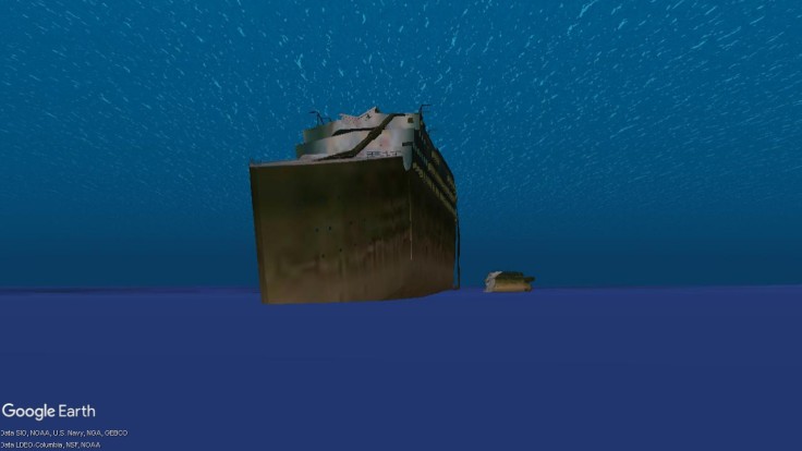
Click and drag Google Street View's mascot, Pegman, near or on the wreck for you to go around 12,600 feet below sea level and see a digital version of the Titanic's wreck.
The digitalized version of the wreck looks almost the same as the actual one, with the bow's deformation caused by its impact on the ocean floor noticeable and the ship's propellers and rudder being highly defined. The only thing missing is the debris field around it and the various coralline algae on the Titanic's wreck.
Visit Vantazo.com.
Related Article : Google Maps is Developing a New Feature for Electric, Hybrid Cars


